
Follow a Mesa Street Address
A sound street-by-street search begins with land, not a claim about the people inside a home. Maricopa County gives each parcel a stable APN and links that parcel to a situs address, an owner, a mailing address, a subdivision, and a current deed reference. Those fields let the same place move across map, deed, permit, and directory sources even when a street string is incomplete.
- Enter one complete Mesa address in the Maricopa County Assessor search. Save the Mesa owner, APN, situs address, owner mailing address, subdivision or MCR, and current deed number.
- Open Parcel Viewer and pan along the Mesa road. Select adjoining Mesa parcels with a line, extent, polygon, or buffer, then open each result on its own.
- Use the Mesa deed number in the Recorder index. Match the parties, legal description, and recording date before following a seller into an earlier deed.
- Use voter information only through the identity-keyed or authorized county routes. It is not an anonymous Mesa street browse, and protected voters are omitted.
- For an older Mesa household snapshot, consult a dated criss-cross directory, then use Mesa permits, code records, or the address-keyed fire request for property activity.
This sequence makes the Mesa address trail a record chain rather than a loose name list. Each step answers a different question. Ownership, municipal activity, and a dated directory entry should not be merged into one claim of current residence.
Mesa Street Directory Search Fields
Maricopa County Assessor search help documents the inputs behind an effective Mesa lookup by address. A Mesa address search works best with the number, direction, street, and an abbreviated type. City, state, and ZIP are optional. If a full Mesa query fails, the Assessor advises omitting the street type. Mesa owner searches work best with a full first name rather than an abbreviation.
| Search choice | Input | Format or use |
|---|---|---|
| Mesa parcel number | One APN | Dashes are optional |
| Mesa owner name | Full name | Use the full first name |
| Mesa address | Number, direction, street, type | City, state, and ZIP may be added |
| Business property | Name, address, account, roll, or lease | Use for business or personal-property accounts |
| Mobile home | Owner, address, account, or VIN | Separate mobile-home mode |
The Assessor help screen shows how these modes are framed.
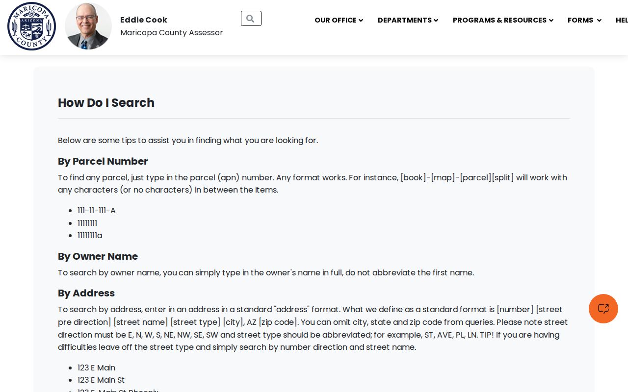
The format notes matter when a valid Mesa address returns no quick match, especially where direction or street type was entered in a different form.
Build a Mesa Street Segment
Parcel Viewer shape-search help turns one Mesa parcel into a practical by-street set. Under Search By, choose the Mesa parcel layer, then select point, line, polyline, extent, circle, polygon, or freehand polygon. A line can follow one side of a Mesa road. An extent or polygon can frame a short Mesa block. Create New Results starts the set, while Add to Current Results and Remove from Current Results refine it.
Buffer Graphic expands around a selected Mesa line or parcel by a chosen distance. Multi-part selection can combine more than one Mesa shape before the search runs. The control is useful, but the Mesa result still needs parcel-by-parcel review. Open Property Information for each Mesa lot and distinguish the site from the tax mailing address.
The official map help illustrates the available shapes and buffer control.
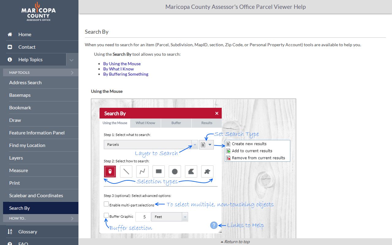
That spatial method is faster than typing every house number, yet it does not turn map geometry into a roster of occupants.
Locate Mesa Parcels Precisely
The Parcel Viewer locate guide accepts Mesa APN, address, and owner. Its broader Mesa known-value search also supports subdivision, MCR, section-township-range, ZIP, MapID, and personal-property account. Mesa owner names are entered surname first without a comma. Mesa address autocomplete uses the number and street, with optional direction, type, and ZIP, and shows only a limited set of suggestions at once.
The locate screen shows the direct routes from a Mesa address or owner to the mapped parcel.
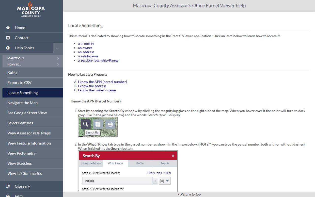
Once a Mesa parcel is open, Property Information, sketch, aerial imagery, tax summary, and other links give context. The APN is the strongest bridge between those Mesa map views and county records.
- Parcel
- A mapped unit of land identified by an assessor parcel number, or APN.
- Situs address
- The physical location assigned to the parcel, which can differ from the owner's mailing address.
- Plat
- A recorded map showing lots, blocks, streets, and subdivision boundaries.
- Criss-cross directory
- A dated directory arranged by street and house number rather than only by surname.
Mesa Records Indexed by Address
No single source completes a Mesa by-address search. The county and city systems overlap, but each has a defined role. The Assessor fixes the current parcel and owner. GIS shows which parcels adjoin it. Recorded documents carry the land trail. Mesa systems add permits, code matters, zoning history, and some inspection records.
| Mesa address source | Record keeper | Street clue | Access route |
|---|---|---|---|
| Mesa property roll | Maricopa County Assessor | Owner, APN, situs and mailing address | Free online search; staff parcel-history help |
| Mesa parcel geography | Assessor GIS | Adjoining parcels and spatial filters | Free Parcel Viewer |
| Deeds, liens, plats, CC&Rs | Maricopa County Recorder | Parties, legal description, recorded chain | Free index and unofficial image; paid official copies |
| Permits and code | City of Mesa | Address-keyed work, applications, and cases | DIMES and city records requests |
| Mesa voter records | Maricopa County Recorder | Lawfully available registered-voter fields | Identity and authorized-use rules apply |
| Mesa historic directories | Library and archives | Dated householder snapshots | Digital items and in-person collections |
When the web tools fail, use the documented channels. Assessor staff handle ownership or mapping questions and parcel-history reports. The Recorder offers a Phoenix counter, mail orders, phone help, appointment inspection, and Title 39 request routes. City departments accept record-specific forms. Those fallbacks are part of the street-by-street method, not a last resort to ignore.
Bridge Mesa Addresses to Deeds
The fastest bridge from a Mesa address to a recorded instrument is the deed number on the Assessor parcel card. Enter that number in the Maricopa County Recorder search, then compare grantee, grantor, recording date, and legal description. For an older transfer, search the seller as a grantee in an earlier date range. Trusts, HOAs, and subdivisions belong in Business Name mode.
The Recorder's full-text Research mode covers only the latest two years, so a failed address phrase does not mean the document trail ends. Structured party, document-number, date, document-code, docket/book, and page searches reach beyond that narrow text window. Use subdivision or MCR data from the Assessor, shorten a subdivision name when needed, and select Plat Maps when looking for the filed map.
Mesa web images are unofficial and free to view. Official Mesa copies cost $1 per page, with $3 added per document for certification. Free Mesa record inspection is available by appointment at the Recorder's Phoenix office, and Mesa mail orders use a self-addressed stamped envelope. Mesa is not the county seat, so this core Mesa land-record channel is centered in Phoenix.
Search Mesa Street Permits
Mesa DIMES searches permit and planning material from 2017 forward without an account. Use the quoted address, a record number, or a name, then open the blue record-number link. Its property lookup can search Address, Parcel Information, Owner, Record Information, or Licensed Professional. The address form supports a street-number range, direction, name, type, unit, city, state, ZIP, and city program codes.
The DIMES screen keeps the Mesa by-address trail tied to municipal activity at a specific place.
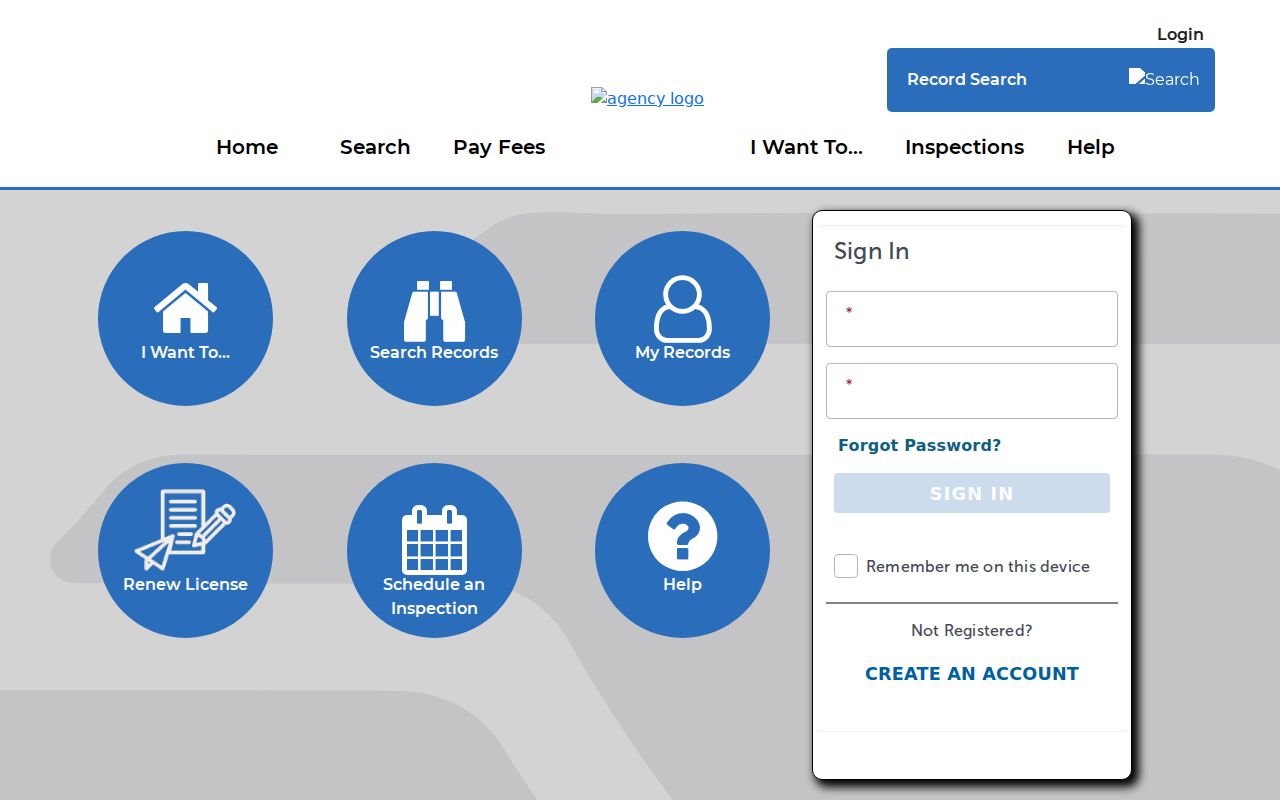
Pre-2017 Mesa documents and zoning-verification letters require a logged-in Document Retrieval request, one Mesa address or property per request. A Mesa permit may name an owner, applicant, or contractor, but none of those fields alone proves who occupied the site.
Read Mesa Permit Data by Street
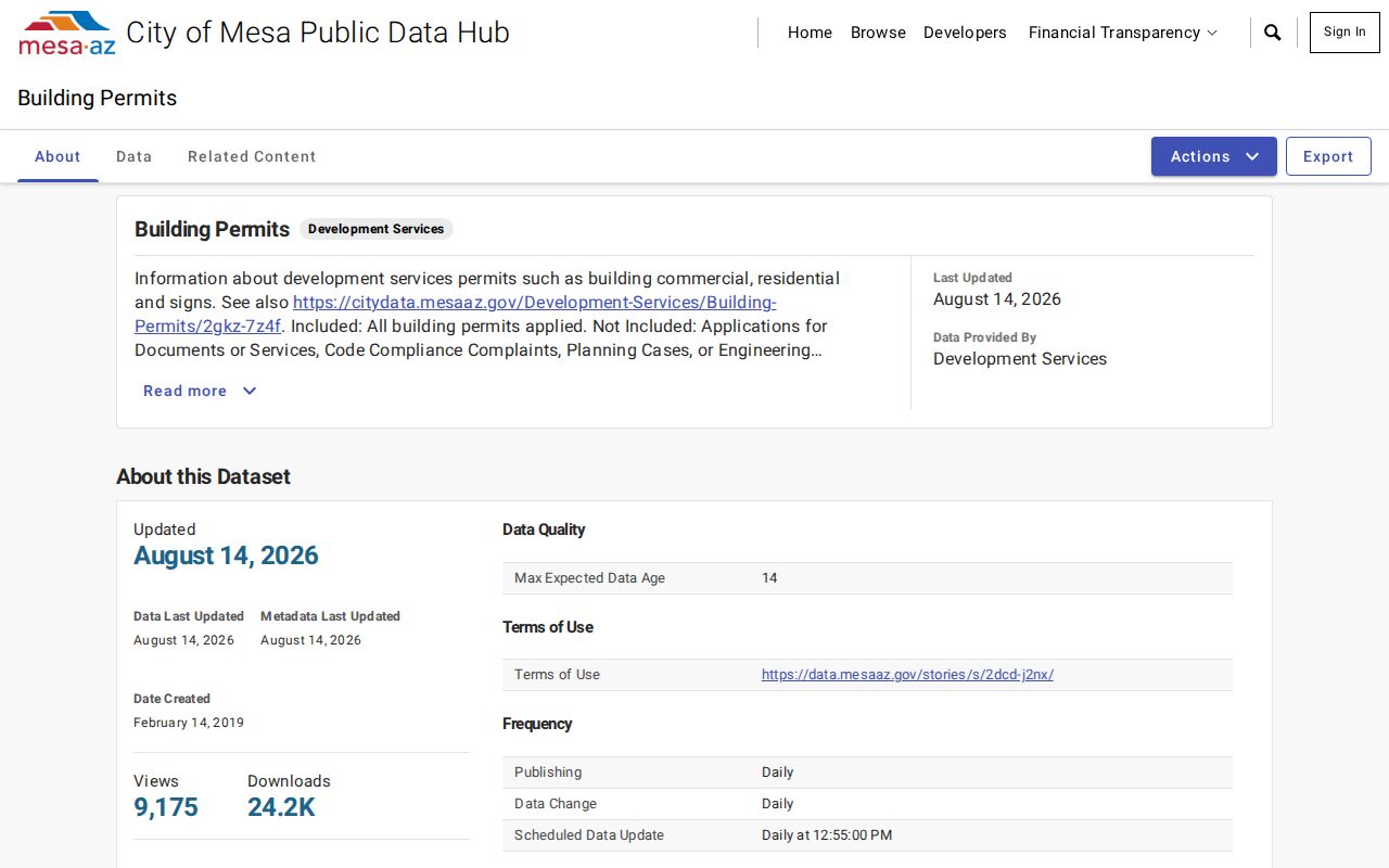
Mesa also publishes an open building-permits dataset. Its dashboard can filter by council district, status, ZIP, and address. That makes it useful for checking a road segment after Parcel Viewer has supplied the set of lots. The open data is an index into municipal activity, while DIMES or a departmental request supplies the record context.
The city dataset view shows how address and status filters frame the permit results.
Mesa Fire records add a separate address-based clue for commercial property. The office stores requests by full address rather than APN and supplies the prior three years of inspection and hazardous-material history, one address per portal request. Keep both the full address and the APN because the city and county systems key the same place in different ways.
Check Mesa Street Address Ranges
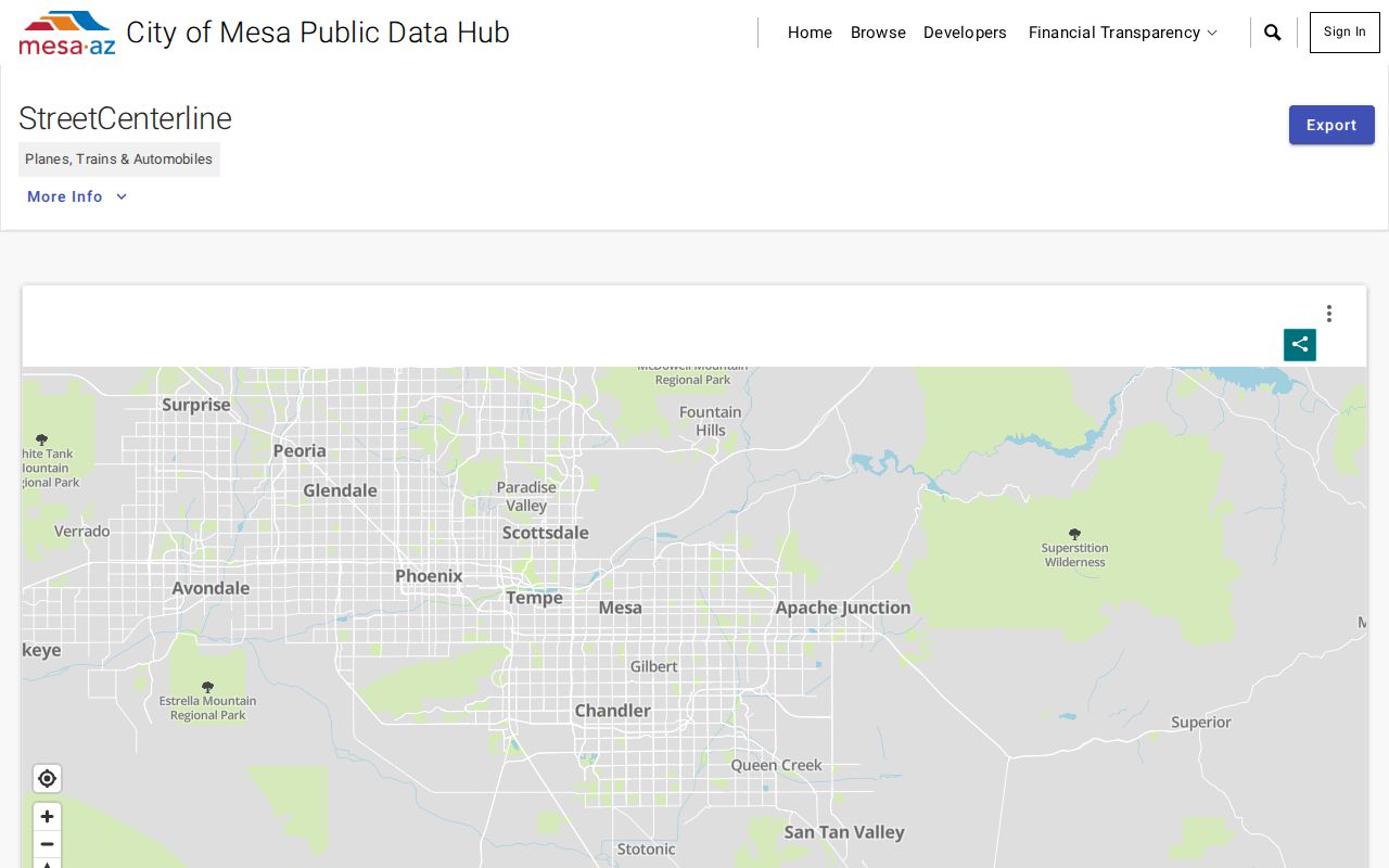
The Mesa Street Centerline dataset records the low and high address range on each side of a segment, along with public or private maintenance. Those fields help test whether a house number belongs on the selected segment before a parcel search. They also prevent a by-address search from drifting to another part of a long road.
The centerline interface exposes those left and right range fields for Mesa by-street work.
A Mesa address hit in the broader city dataset is not always a home. Mesa assigns asset addresses to hydrants, signals, poles, meters, and streetlights. Check the Mesa site's classification, parcel, and legal geography before treating a result as a residential place.
Mesa Streets Across Changing Limits
Mesa remained a one-square-mile townsite for its first fifty years. Six subdivisions annexed in 1930 doubled its area. By 1950 the city exceeded six square miles, and by 2000 it covered 125 square miles. That change explains why a postal Mesa line, an old directory entry, and today's municipal boundary may not describe the same geography.
For older street research, save the legal description and subdivision rather than depending on a modern ZIP. The 1952 Mesa Householders' Directory and Street Telephone Guide offers a true reverse view, arranged by street with householders, ownership marks, and available phones. The Mesa city directories give the verified collection details and entry key.
Historic plats also help date when a road or lot should begin to appear. Research anchors include Evergreen plats from 1910 and 1912, Gold Spot Groves from 1931, McLellan Acres from 1946, North Lehi Acres and Lehi Subdivision from 1947, and Granite Reef Estates from 1954 and 1955.
Limits of a Mesa Street Directory
A tax-roll owner is not necessarily a Mesa occupant. The mailing address may differ from the situs address because of a trust, an off-site owner, or a mailing preference. People who do not own the parcel, children, and other household members normally do not appear on the parcel card. A deed records a conveyance, not the date someone moved. A permit identifies activity and named participants, not all people at the site.
Arizona voter information is also not a casual Mesa street list. The public self-service portal is identity-keyed. A person-specific Mesa request needs a full name, date of birth, and last known address, and protected voters are omitted. Arizona law limits uses of Mesa voter files. Mesa utility customer names, addresses, and payment data are privileged and unavailable, while motor-vehicle address data is restricted by federal law.
Lawful use. Use Mesa address records for legitimate personal, family, civic, or property research. Never use them to stalk, harass, threaten, or intimidate anyone.
The best address result states what each record proves and where it stops. Verify uncertain facts with the office that keeps the source.